


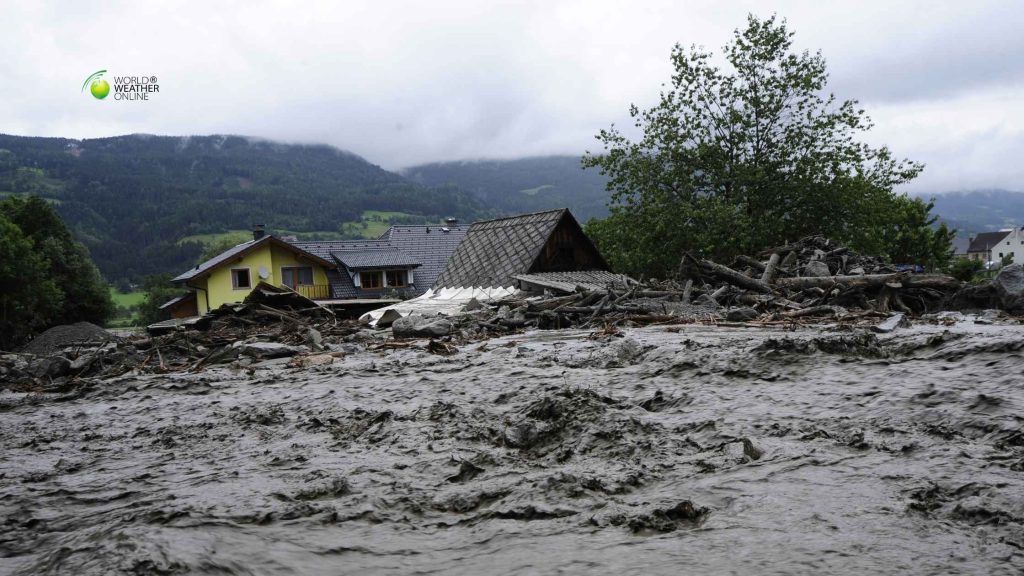
On 26th August 2026, a mass of mud, ice and boulders swept through the Lhende Khola valley. Eventually, it crossed the Nepal-Tibet border and entered the Bhote Koshi and Trishuli rivers. Resultantly, settlements and infrastructure collapsed within minutes.
However, this disaster began when part of a glacier and the rock beneath it broke away near Langtang Lirung.
Where the Glacier Collapsed
Langtang Lirung is a 7,234-metre peak in Nepal’s central Himalayas. The failed ice mass lay lower down on its northern side, near Tibet. It has no consistently verified official name. So, it should not be confused with the separate Yala or Langtang glaciers.
Satellite images revealed that bedrock beneath the glacier also failed at an altitude of about 5,200 metres. The rock carried the overlying ice with it. Consequently, the mass then fell roughly 1,200 metres into the upper Lhende Khola valley.
Moreover, a Tribhuvan University expert estimated that around five million cubic metres of ice and rock were released. This remains a preliminary figure. Even so, satellite images show that a large section of the mountainside disappeared.
How the Collapse Turned Into a Flood
The falling material shattered as it struck the valley. It mixed with river water and loose sediment, then gathered more debris downstream.
Researchers are examining whether the avalanche temporarily blocked the narrow Lhende Khola. If that natural dam formed and failed, it may have added another violent pulse to the flood. The explanation is plausible, but it has not been confirmed.
The surge entered the Bhote Koshi and later the Trishuli. At Galchhi, the Trishuli rose by as much as nine metres in 30 minutes. At Malekhu, it climbed about seven metres over a similar period.
The event has sometimes been called a glacial-lake outburst flood. That description is misleading because no established glacial lake is known to have burst. The evidence points instead to an ice-rock avalanche that created several connected hazards.
Why It Looked Like an Earthquake
Monitoring systems recorded a magnitude 5.2 seismic event near the border. Early reports suggested that an earthquake had triggered the collapse.
The US Geological Survey later linked the signal to the falling rock, ice and debris. The collapse shook the ground with earthquake-like force. So, no evidence has established an earthquake as the trigger.
The Damage Continued Far Downstream
The flood damaged or destroyed at least 19 bridges and around 40 kilometres of road. Eleven hydropower projects stood in the affected region, while six major facilities suffered serious damage. More than ten percent of Nepal’s electricity-generating capacity was lost.
By 5 September, Nepal had recorded at least 1,344 deaths. Around 4,887 people remained missing, including 583 foreign nationals. Tibet had reported 31 deaths and 531 missing people. These totals may change as rescue and identification work continues.
Around 900 people were believed trapped in hydropower tunnels. Rescuers found Nepali workers Kabir Maharjan and Sanjay Sah alive after nine days. Sah had remained in a control room to warn colleagues before attempting to escape.
The following day, Chinese worker Lu Haitao was rescued from a 225-metre tunnel at the Upper Trishuli-1 project. Chandika Kumari Shrestha was also found alive inside her flooded home in Betrawati. Their survival brought hope to families still waiting for news.
What May Have Weakened the Mountain
Scientists have not identified one immediate cause. Meltwater may have entered cracks and reduced friction beneath the ice. Thawing permafrost may also have loosened rock previously held together by frozen ground. Retreating ice can remove support from a steep slope.
Radar satellite data indicated that the glacier-and-rock mass was accelerating before it collapsed. This suggests that the mountainside was becoming unstable, although it does not reveal the final trigger.
Climate change cannot be presented as the proven sole cause. However, warming increases melting and changes cycles of freezing and thawing. It also weakens glaciers, permafrost and exposed rock across high mountain terrain.
The Hindu Kush Himalaya has lost close to one-third of its glacier ice in little more than 30 years. The consequences include smaller glaciers and, in some locations, increasingly unstable slopes.
Why the Warning Arrived Too Late
The flood struck a Tibetan border crossing at about 8 in the morning. A Nepali hydrologist received confirmation around half an hour later. So, communities closest to the collapse had almost no time to respond.
Resultantly, at least four river gauges were damaged or washed away. Nepal now plans to install cameras, seismic sensors and satellite communications near the border. It is also seeking more frequent glacier and river data from China.
Can the Next Collapse Be Detected Earlier?
In a nutshell, monitoring above 5,000 metres remains difficult. The terrain is dangerous, clouds obscure optical satellites and communications often fail. Radar satellites can detect movement through clouds. Seismic sensors can recognise large collapses, while stronger river gauges can follow the resulting surge.
Yet detection alone will not save lives. Alerts must reach residents immediately, and communities need clear evacuation routes. Even a few minutes can matter when people know where to go.
Ultimately, reducing future losses will require shared data, dependable warnings and safer infrastructure. The rivers are connected across the border. The protection of the people living beside them must be connected too.
The post Nepal’s Glacier Collapse: How a Mountain Unleashed a Cross-Border Flood appeared first on Weather Blog.


